
Súbor:Philippines location map.svg

Veľkosť tohoto PNG náhľadu tohoto SVG súboru: 454 × 599 pixelov. Iné rozlíšenia: 182 × 240 pixelov | 364 × 480 pixelov | 582 × 768 pixelov | 776 × 1 024 pixelov | 1 552 × 2 048 pixelov | 1 871 × 2 468 pixelov .
Pôvodný súbor (SVG súbor, 1 871 × 2 468 pixelov, veľkosť súboru: 2,18 MB)
Zhrnutie
| Popis |
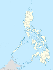
Deutsch: Positionskarte der Philippinen
Quadratische Plattkarte, N-S-Streckung 103 %. Geographische Begrenzung der Karte:
English: Location map of the Philippines
Equirectangular projection, N/S stretching 103 %. Geographic limits of the map:
|
| Dátum | |
| Zdroj |
own work, using
|
| Autor | NordNordWest |
| Ďalšie verzie |
|


|
Tato mapa byla vytvořena nebo vylepšena v německé Kartenwerkstatt (Mapová laboratoř). Můžete také navrhnout mapy k vylepšení.
|
Licencovanie
Ja, držiteľ autorských práv k tomuto dielu ho týmto zverejňujem za podmienok nasledovných licencií:

|
Bolo udelené povolenie kopírovať, širiť a/alebo meniť tento dokument za podmienok GNU Free Documentation License, verzie 1.2 alebo ktorejkoľvek neskoršej verzie publikovanej Free Software Foundation; bez Nemenných častí, bez Textov na prednej obálke a bez Textov na zadnej obálke. Kópia tejto licencie je zahrnutá v časti nazvanej GNU Free Documentation License. |
Tento súbor podlieha Creative Commons Attribution 3.0 Unported licencii
- Môžete slobodne:
- zdieľať – kopírovať, šíriť a prenášať dielo
- meniť ho – upravovať dielo
- Za nasledovných podmienok:
- uvedenie autorov – Musíte spomenúť autorov (jednotlivo alebo kolektívne), poskytnúť odkaz na licenciu a uviesť, či ste niečo zmenili. Môžete to urobiť ľubovoľným primeraným spôsobom, ale nie spôsobom naznačujúcim, že poskytovateľ licencie podporuje vás alebo vaše použitie diela.
Môžete si zvoliť ľubovolnú z týchto licencií.
História súboru
Po kliknutí na dátum/čas uvidíte ako súbor vyzeral vtedy.
| Dátum/Čas | Náhľad | Rozmery | Používateľ | Komentár | |
|---|---|---|---|---|---|
| aktuálna | 22:17, 25. marec 2016 | | 1 871 × 2 468 (2,18 MB) | Man77 | upd NIR, Davao |
| 11:46, 14. október 2013 |  | 1 871 × 2 468 (2,2 MB) | Hariboneagle927 | fix | |
| 11:07, 14. október 2013 |  | 1 871 × 2 468 (2,15 MB) | Hariboneagle927 | fix. Cagayan | |
| 10:58, 14. október 2013 |  | 1 871 × 2 468 (2,15 MB) | Hariboneagle927 | Made some update and corrected some minor errors. | |
| 07:22, 9. október 2013 |  | 1 871 × 2 468 (2,14 MB) | Hellerick | Regrouped for easier recoloring. | |
| 06:13, 7. august 2013 |  | 1 871 × 2 468 (1,07 MB) | Hellerick | Regional division replaced with provincial division. | |
| 19:09, 5. júl 2009 |  | 1 871 × 2 468 (1 009 KB) | NordNordWest | ||
| 21:04, 25. máj 2009 |  | 1 687 × 2 469 (999 KB) | NordNordWest | {{Information |Description= {{de|Positionskarte der Philippinen}} Quadratische Plattkarte, N-S-Streckung 103 %. Geographische Begrenzung der Karte: * N: 21.2° N * S: 4.3° N * W: 115.4° O * O: 127.3° O {{en|Location map of the [[:en |
Použitie súboru
Žiadne stránky neobsahujú odkazy na tento súbor.
Globálne využitie súborov
Nasledovné ďalšie wiki používajú tento súbor:
- Použitie na af.wikipedia.org
- Použitie na als.wikipedia.org
- Použitie na an.wikipedia.org
- Použitie na az.wikipedia.org
- Použitie na be-tarask.wikipedia.org
- Použitie na be.wikipedia.org
- Použitie na bn.wikipedia.org
- Použitie na ce.wikipedia.org
- Použitie na ckb.wikipedia.org
- Použitie na crh.wikipedia.org
- Použitie na cs.wikipedia.org
Zobraziť ďalšie globálne použitie tohto súboru.